The Big Blue
Big Blue Golden Gate was going to be a first in many ways. It was the first time this race had been held and it was the first time this group of people had raced together. The team for the day was Mari Chandler, Mike Prindiville, Craig Dalton and Mark Manning. Mike wanted to take a break from navigation so the maps were up to me. He would be providing horsepower on the bike and run along with Mari and Craig.
For a race that started less than a mile from my house I still had to get up at some awful hour in the morning to get everything ready before the map pickup at 06:30. We drove to the start and managed to get rock star parking as few other people had arrived yet. It was still dark and teams were setting up their gear with headlamps on.
The whole team arrived around 6AM and we staged the boats on the beach in a long line facing the water. There looked like a small armada of kayaks, of all shapes and sizes, from the super fast triples to plastic sit-on-tops. There must have been at least 50 boats.
We had the pre race briefing where Todd Jackson told
everyone very clearly that they should read all the instructions for a section
before they start it. This would save
valuable time later. As it turns out some
of the teams must have missed that part of the discussion. The organizers had arranged the navigation in
a Mission Impossible style with different clues or instructions for nearly
every checkpoint. We were handed the
first set of mission instructions and it included a picture of a boat that we
would have to find somewhere in the Bay and the route we would have to take in
the kayak. Rumors went around at the
start that the boat had been seen somewhere near Fisherman’s Warf so we would
head that way after doing the loop around
Mike and I had a quick discussion and decided that we would start off by going around the North of Alcatraz and if that didn’t look like the fast route we would cut to the South of the island and around the buoy depending on how the current was taking us. The South side of the island proved to be faster once the current took us that way.
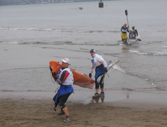
All the teams lined up by their boats ready for the run into
the surf. We were next to a team that
had sit-on-top boats and were wearing wet suits. When we were given the start signal everyone
picked up their boats and ran to the surf.
Craig and I were one of the first boats to the water. We jumped in and started paddling like
crazy. Mike and Mari were just behind us, as they pulled
along side in their faster fiberglass boat we clipped on the tow line and
headed towards
We were probably 4th or 5th boat as we
reached the halfway point to
Having got CP 3 it was a sprint back to the beach and the
transition to the bike. On the way back
we passed
We came out of the water in about 5th place and dragged the boat up the beach. I tried to lift it but it was still full of water from the wave that came over us and I had to drop it again. I told Craig to just drag the bloody thing into the TA as it was way too heavy to carry.
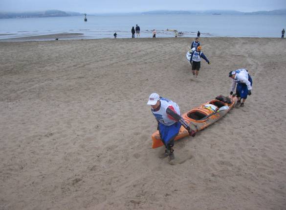
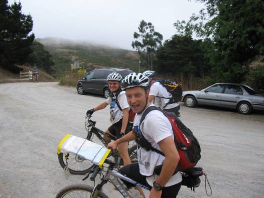
Once the boat was safely dumped in the TA we changed for the bike section and picked up the next set of instructions.
The instruction sheet included a selection of photographs
and some heading and distance values for various locations in the Marin
Headlands. The instructions also
included information on a mandatory 25 minute “transit time” to get to the next
CP that was located at the North end of the
When we arrived at CP 6 we’d caught team Ultimate Direction
and left the CP before them as they were still looking at the pictures to try
and locate CP 7. I’d had the pictures
out all the time on the Mountain
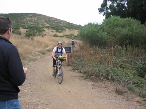
Bike Map Holder and we’d spotted CP 7 while we were on our way to CP6. The map holder gave us a big advantage as we
were able to read the maps and clues while still moving. We signed in at CP7 and dropped our bikes for
the run up to CP8. This was a short
climb up the side of a gun battery to a lookout point on the hill. We ran into a number of teams as was came
back down the hill and picked up our bikes.
We wasted no time deciding how to get to CP 9 which was at the stables
in
As we came down into the stable area we could hear cheering and whooping coming from Bruce, Hailey and Colleen who had made the trip out from the start to see us come through the CP. It was great to see them.
We collected the signature from the manned CP and went on to
the next part of the loop that took us up the next major climb and over to
We then had a nice descent down “big air” trail also known as Mewok (keeping the 15mph limit of course) and back to the stables to check in. The supporters were there again, but we caught them by surprise this time. There wasn’t so much noise.
As we climbed back up the hill past the stables towards
We found out later that a couple of teams hadn’t read the instructions carefully enough. The instructions for CP 12 said something like “from CP 13 plot 270.5 deg TN for 1.08 miles”. Some teams waited until they reached CP 13 and decided to plot CP 12. When they did this they found that they had to go back up the 800 foot single track climb that they had just come down, because they had ridden right past CP 12 at the top of the mountain. This must have hurt! I’ve done that climb on Miwok trail once and swore I’d never do it again. Well that took care of our main competition.
We hit the
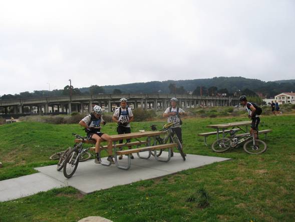
We arrive back at the TA and still had a few minutes in hand to set ourselves up for the next section. We sorted the maps, ate some food and put on our running shoes ready for the trek in the Presidio. While we were eating and getting prepared we even did a little interview with the San Francisco Chronicle as we were the first team through.
When the time limit was up we checked in and dropped the
bikes ready for the trek. We found the
instruction on the board and they said that we needed to go to
When we reached the Sports Basement we found Todd Jackson there with our next set of instructions. This was another plotting exercise that suited the Basic Roamer AR perfectly. We were done plotting the 4 points in less than 3 minutes with Todd looking on.
We could get these points in any order and this is where things started to go wrong for us. We later found out that we had a 34 minute lead on the second place team heading out to the trek but we didn’t know that at the time. We hit CP 20 almost spot on and counted the number of cannon balls on the parade ground. Next was CP 19. On the map it looked to be located in the middle of a park area. We went straight there and found the small park with a well in the center, but there was no CP flag. We stopped and plotted the CP again but the second plot put us in exactly the same place. I then tried plotting from grid north rather than true north just in case there had been an error in the course setters plotting. This put us on the next street over. We went there but still found no CP. We spent the next 45 minutes looking down every trail and other street around, while checking our plotting again, but it all pointed back to the small park area. At this point we were desperate and Mike decided to lift the lid on one of animal proof trash cans that was at the side of the park and there was the CP flag. Some local moron had taken it down from the tree and thrown it away. We had lost so much time with this one CP that I was sure we’d lost the lead, but no other teams had come through. We placed the CP back where we thought it should be and continued on. We sprinted through the rest of the CP’s and it was a crazy blur of bushes and trees. I was firmly attached to Mari’s tow line even when she jumped straight off a 4 foot cliff. Lucky it’s a long piece of bungee.
The pace from the last CP back to the finish was really painful. I had the bungee on full stretch as Mari towed me along. We could see the finish from a long way out, that yellow Salomon tent looked so good. We came across the line to our friends jumping up and down.
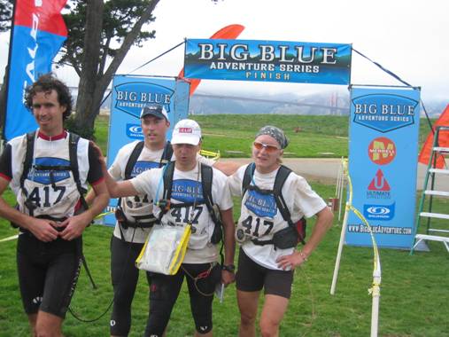
We’d finished the race but it wasn’t over yet. The team that crossed the line in front of us had done the trek loop in the opposite direction to us, which meant that they came across CP 19 after we had removed it from the trash can and placed it back in the circle. They lost no time because of it being thrown away. There was a short and very amicable discussion between Todd Jackson, Team Luna and us which resulted in a small time bonus for replacing the flag. If we hadn’t had taken the CP flag out of the trash, the other teams would have either had to skip the CP or spend additional time searching for it. I’d like to say a big thank you to team Luna for working with us in the end.
This small bonus gave us back the lead and the overall win for the Big Blue Golden Gate adventure race. The team did a fantastic job and worked together really well to finish the event in a fast time.
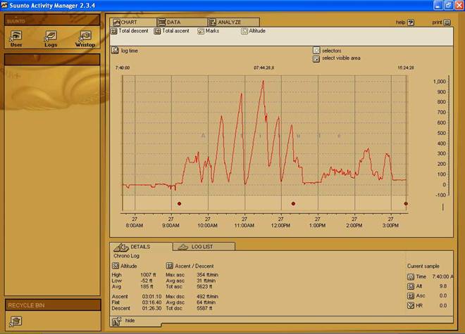
Suunto Download for Big Blue
A big thank you to our sponsors for this event
The gear and support they provided us was the key to our success during this event.
![]()
![]()